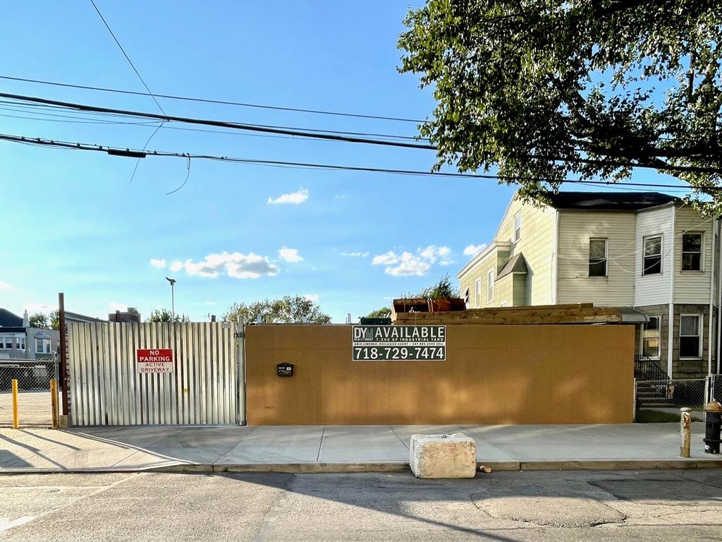
7,200 sf Queens Industrial Land
Description
For Lease:
7,200 sf of industrial zoned land located in Ridgewood, Queens. Site is improved with two stacked standard 20' containers for storage with power connections within, 200amp/ 3-phase power, water access & corrugated steel fencing.
Documents
Location
Sq Ft
Financials
Construction
Image Gallery
Area Profile
North Brooklyn (Greenpoint, Williamsburg, Bushwick, Ridgewood)
North Brooklyn, including areas like Greenpoint, Williamsburg, Bushwick & Ridgewood, have historically been prominent industrial areas, but have since evolved to vibrant mixed-use neighborhoods featuring a blend of residential, commercial, light industrial and creative uses, that contribute to a dynamic and diverse urban fabric.
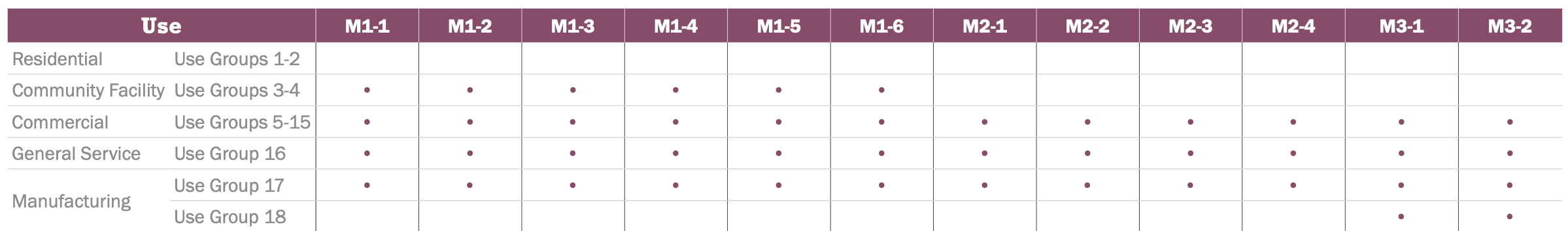
Zoning
M1-4D Zone
M-zones are designed to accommodate a variety of industrial and manufacturing activities, including heavy and light manufacturing, warehousing, distribution centers, and storage facilities. These areas are regulated by zoning laws to ensure compatibility with surrounding neighborhoods and to manage issues such as noise, traffic, and environmental impacts.
Typical Uses
Typical uses include warehousing and storage, wholesale services, showrooms, media production, repair centers, etc.


R5-B Zone
R-zones are intended for residential development, encompassing a wide range of housing types from single-family homes to apartment buildings. These zones are regulated by zoning laws to ensure that residential buildings meet specific density, height, and setback requirements to maintain neighborhood character and quality of life.
Typical Uses
Lower density developments such as detached or semi-detached single-family homes, townhouses, and low-rise apartment buildings.