Maspeth Landing: Build To Suit Opportunity
Description
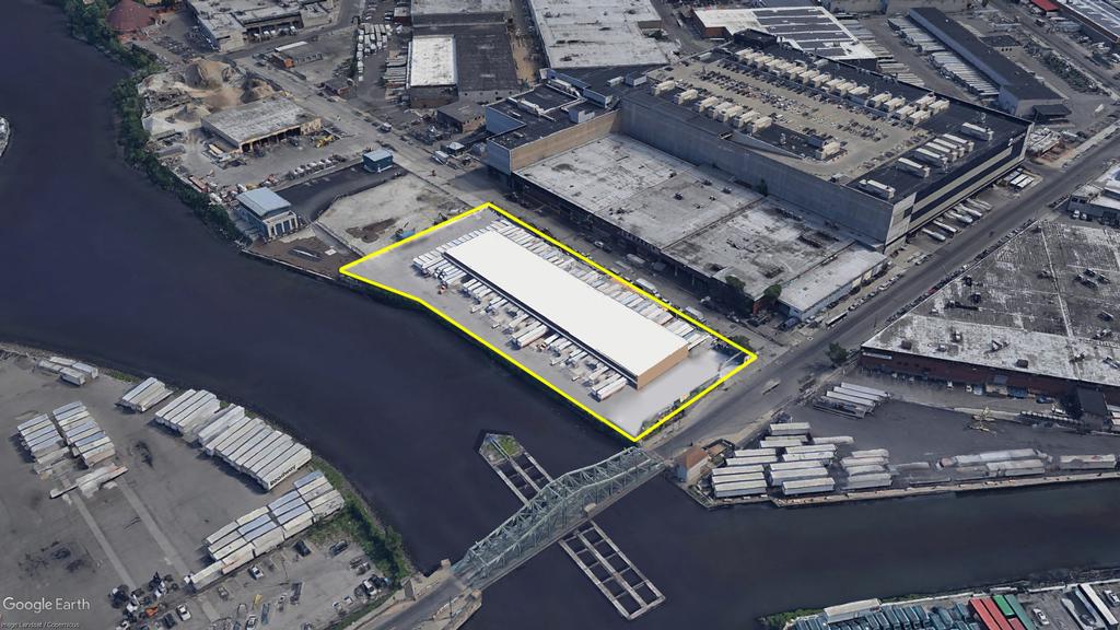
Tremendous build-to-suit opportunity in Maspeth, with up to 180,000 square feet of industrial buildable. Ample parking possible, as well as multi-story applications and utilization of 365 feet of bulkhead along the Newtown Creek. Extremely rare chance to create a long term and logistical presence in the geographic center of New York City.
Documents
Location
Sq Ft
Financials
Construction
Image Gallery
Area Profile
Western Queens (LIC, Astoria, Maspeth, Woodside)
The Western Queens area, including neighborhoods like Long Island City, Maspeth, Astoria, & Woodside, has long been a significant industrial hub in Queens, known for its mix of manufacturing, warehousing, and distribution centers as well as its proximity to Manhattan. Despite residential rezoning along the waterfronts in Long Island City and Astoria, Western Queens still retains a substantial industrial presence and has further evolved into a major hub for the film and television industry.
Maspeth in particular has remained a predominantly industrial area. As the geographic center of New York City, is a strategic location for logistics, distribution and warehousing as well as heavy manufacturing.
Proximity to Major Highways: Strategically located near major highways such as the Long Island Expressway (I-495), Brooklyn-Queens Expressway (I-278), and Grand Central Parkway.
Access to Bridges and Tunnels: Convenient access to several key bridges and tunnels, including the Queensboro Bridge (59th Street Bridge), Triborough Bridge (Robert F. Kennedy Bridge), and Queens-Midtown Tunnel.
Public Transportation Hubs: Served by multiple subway lines (such as the 7, N, W, E, M, R) and bus routes, providing residents and workers with extensive public transportation options.
Proximity to Airports: Close to LaGuardia Airport, one of New York City's major airports, facilitating convenient access for businesses involved in logistics and transportation.
Zoning
M3-1 Zone
M Zones
In New York City, areas designated as M-zoned are primarily intended for industrial and manufacturing uses. Here's a summary of M-zoned areas across the city:
1. Purpose and Zoning Regulations:
- M-zones are designed to accommodate a variety of industrial and manufacturing activities, including heavy and light manufacturing, warehousing, distribution centers, and storage facilities.
- These areas are regulated by zoning laws to ensure compatibility with surrounding neighborhoods and to manage issues such as noise, traffic, and environmental impacts.
2. Types of M Zones:
- M1 - Light Manufacturing: Typical uses include warehousing and storage, wholesale services, showrooms, media production, repair centers, etc.
- M2 - Medium Manufacturing: Typical uses include warehousing and storage, transportation facilities, utility services, construction related services, heavy repair, auto uses, etc.
- M3 - Heavy industrial: Typical uses include power plants, bulk storage, recycling and waste management, heavy repair, construction facilities, concrete plants, etc.