East Williamsburg User/Developer Site
Description
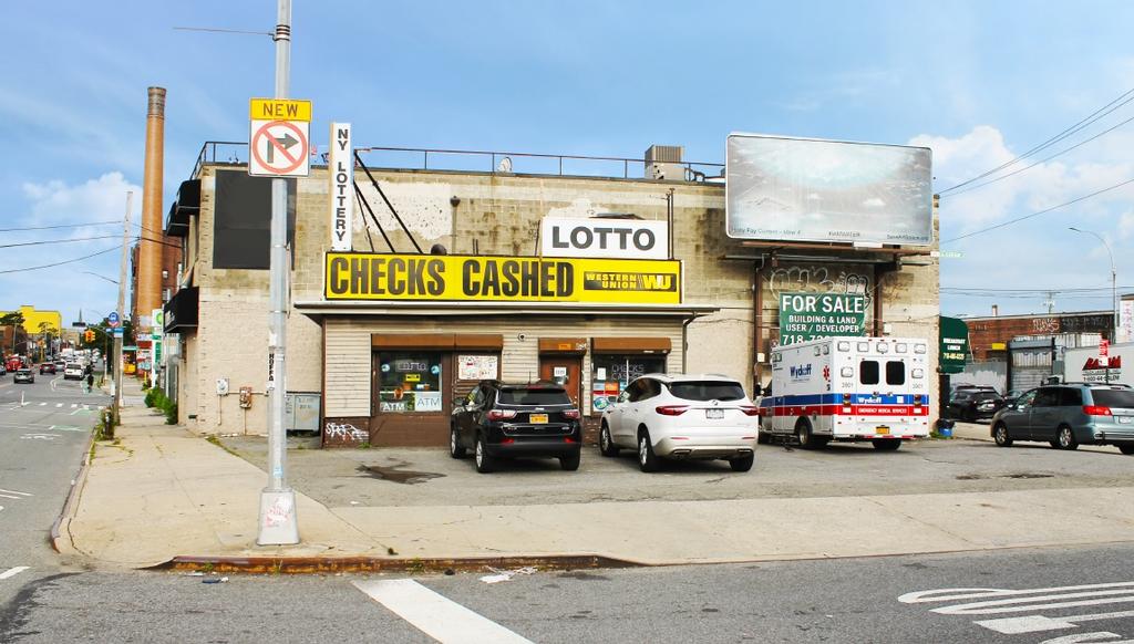
DY Realty Group has been retained on an exclusive basis to handle the sale of 1120 Metropolitan Avenue in Williamsburg, Brooklyn. The property consists of a 3,895 sf plot, zoned M3-1. The site has an FAR of 2.0, with a maximum of 7,790 buildable square feet. The site is located at the intersection of Metropolitan Avenue and Grand Street in Williamsburg, Brooklyn, minutes from the Williamsburg Bridge.
Documents
Location
Sq Ft
Financials
Construction
Image Gallery
Area Profile
North Brooklyn (Greenpoint, Williamsburg, Bushwick, Ridgewood)
North Brooklyn, including areas like Greenpoint, Williamsburg, Bushwick & Ridgewood, have historically been prominent industrial areas, but have since evolved to vibrant mixed-use neighborhoods featuring a blend of residential, commercial, light industrial and creative uses, that contribute to a dynamic and diverse urban fabric.
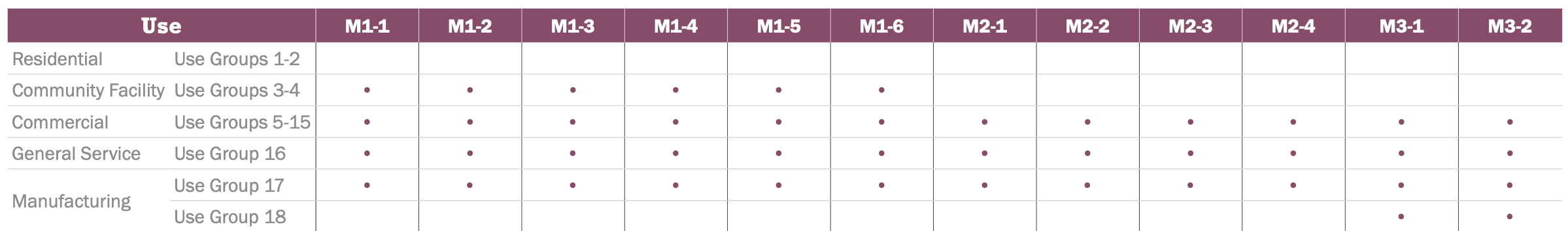
Zoning
M3-1 Zone
M-zones are designed to accommodate a variety of industrial and manufacturing activities, including heavy and light manufacturing, warehousing, distribution centers, and storage facilities. These areas are regulated by zoning laws to ensure compatibility with surrounding neighborhoods and to manage issues such as noise, traffic, and environmental impacts.
Typical Uses
Typical uses include power plants, bulk storage, recycling and waste management, heavy repair, construction facilities, concrete plants, etc.